Tzoumerka (Athamanika) Mountain Range

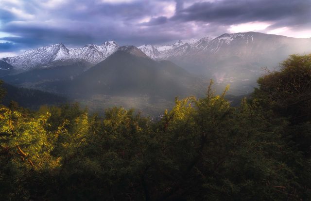
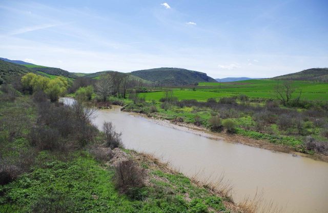
Tzoumerka, also called the Athamanika Mountains, is a mountain range in the southern Pindus, on the border between Epirus and Thessaly. Its highest peak, Kakarditsa, reaches 2,429 metres. The Arachthos river runs along the western side of the range, and the Achelous runs along the eastern side.

The range is part of a national park that has forests of black pine, beech and fir, a river gorge and waterfalls. Stone villages such as Syrrako and Kalarrytes lie inside it, and paths lead from them into the mountains. Rafting trips run on the Arachthos, and the single-arch Plaka Bridge crosses it. The nearest towns are Ioannina and Arta, each about an hour and a half away by car.

TIP: Drag and drop "Pegman" onto zoomed map for a 360o photo view !

Geography

The Athamanika Mountains are about 40 kilometres long from north to south and 15 to 20 kilometres wide. They lie where the four areas of Arta, Ioannina, Karditsa and Trikala meet, and they are part of the southern Pindus. The Arachthos river forms the western edge of the range, and the Achelous forms the eastern edge.

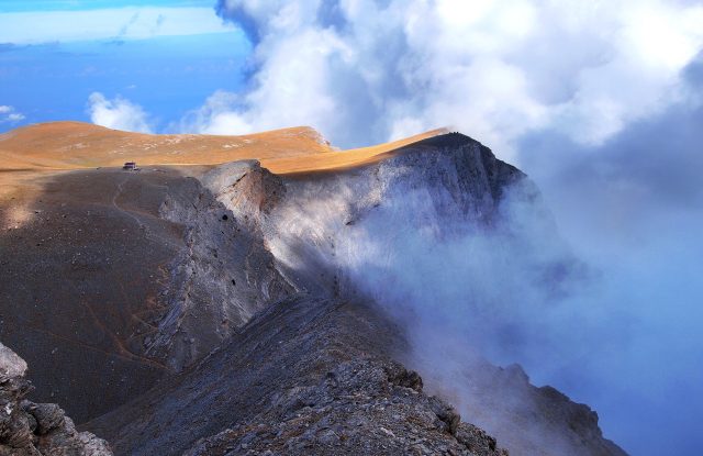
Kakarditsa is the highest peak, at 2,429 metres, and other peaks, such as Strogoula, also rise above 2,000 metres. The high peaks are limestone. The national park around the range covers about 820 square kilometres. It also includes the Peristeri massif, where Syrrako stands, and the Arachthos Gorge, and its height ranges from 144 to 2,429 metres. The main villages stand high on the slopes: Pramanta at about 840 metres, and Syrrako and Kalarrytes at more than 1,100 metres.

Nature & Outdoors

The National Park of Tzoumerka, Peristeri and the Arachthos Gorge was created in 2009 and protects 17 types of habitat. It has forests of black pine, beech and fir, and woods of oak and plane trees. Juniper woods grow at heights of 1,000 to 1,500 metres. Bears and wolves live in the park, and golden eagles and griffon vultures are among its 145 or so bird species. Otters and trout live in the rivers.

There are waterfalls along the walking routes. The Kefalovriso waterfall is about an hour on foot from the mountain refuge at Pramanta or from the village of Melissourgoi, and it is best in spring and early summer. Anemotrypa cave lies about three kilometres from Pramanta. Visitors walk about 270 metres inside it, beside an underground river, with a guide, and the visit takes about half an hour.

Activities

Rafting takes place on the Arachthos, which runs through a deep gorge, and local operators run the trips. One trip starts at the Politsa Bridge near Ambelochori and ends at Plaka Bridge, about 10 kilometres downstream, in rapids of grade II to III on a scale of one to six. A longer trip continues to Tzari Bridge, about 22 kilometres from the start. The Kalarritikos river has a harder run, of grade III to IV. Kayakers paddle the same rivers, and the Kalarritikos is for experts.

One demanding walk is the ascent of Strogoula, at about 2,100 metres. It takes about four hours from the mountain refuge at Pramanta and is moderate to hard, with some exposed places. An easier route is the footpath between Syrrako and Kalarrytes, which takes one to two hours. Canyoning trips are offered near Syrrako.

Villages & Inland

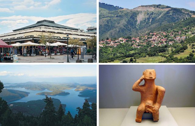
Syrrako is a stone village where narrow lanes lead to a square with two old plane trees. It has small museums, including a folklore museum in the former home of the poet Kostas Krystallis. Under Ottoman rule it was the centre of a group of about forty villages that governed themselves, and its people earned a living from sheep, wool and trade. Ottoman troops destroyed it in 1821, after the villagers joined the revolt, and the villagers returned in 1825 to rebuild it.

Kalarrytes is another stone village, one to two hours away on foot. Both villages are officially listed as traditional settlements, a status that protects their old buildings. Fewer than three hundred people live in Kalarrytes. Other villages, such as Pramanta and Melissourgoi, are the starting points for walks to Strogoula and the Kefalovriso waterfall.

History & Culture

Plaka Bridge crosses the Arachthos with one stone arch, about 40 metres wide and about 20 metres high. It was built in 1866. A flash flood destroyed it on 1 February 2015. The bridge was rebuilt with traditional building methods and with the original fallen stones wherever possible, and the work was finished in 2020. The restoration won a European Heritage Award in 2021. Visitors can walk across the bridge, and rafting trips start or end near it.

Kipina Monastery stands above the Kalarritikos gorge, near Kalarrytes. It was begun in 1212 by the monk Gregorios and is built into a cliff, with the natural rock as its roof. A carved footpath and two bridges, one of them suspended, lead to it. The monastery was deserted in the 19th century.

Practical information

Tzoumerka (Athamanika) Mountain Range:

Getting there

The nearest airport is at Ioannina, and the villages of the range are about an hour to an hour and a half from there by car. Arta is about the same distance. From Athens the drive takes about four to four and a half hours, and from Thessaloniki about four hours. Most visitors arrive by car, and the last part of the road climbs into the mountains.

Getting around

A car is the only practical way to move between the villages, because there are no public buses between them. If you do not have one, arrange it in Ioannina or Arta before you go. Mountain roads are narrow and winding, so driving takes longer than the distance suggests. Walking links some places: the footpath between Syrrako and Kalarrytes takes one to two hours.

Good to know

Trail marking is uneven. The park authority advises walking only in good weather and with hiking experience, and you should carry a map or a GPS track. Anemotrypa cave is visited with a guide, and opening hours vary, so check before you go. Visitors have not always been able to go inside Kipina Monastery, so ask in Kalarrytes before you walk there. Check locally whether the small museums in Syrrako are open.

When to go

Tzoumerka can be visited in every season. Waterfalls such as Kefalovriso are best in spring and early summer. Rafting on the Arachthos is possible for much of the year. The valleys are cool in summer, the forests change colour in autumn, and the peaks are white with snow in winter. Snow can stay on the highest peaks until early summer. Snow can close mountain roads in winter, and some villages are almost empty then.