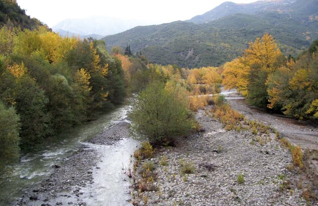
Mount Oeta (Oiti)
- Forest, Gorges, Hiking-Trekking, Mountains, Waterfalls
- Geo Area: Central Greece

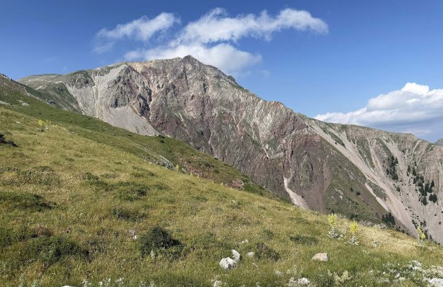
Mount Oeta, named Oiti in modern Greek, is a mountain of 2,152 metres in Central Greece, south of the city of Lamia and the Sperchios River. Part of it has been a national park since 1966. People come here to walk through fir forests, across high meadows with many wild flowers, and up to the peak of Pyrgos. In Greek myth this is the mountain where Heracles died, and the remains of his sanctuary, the Pyre of Heracles, stand high on the southern side. Ypati, a small town on the northern side, has a castle and the steep paths to the high ground. Pavliani, a village in the forest on the southern side, has easier walks and a shorter way to the plateaus.
Geography
Mount Oeta, also written Oiti, rises south of the valley of the Sperchios River, on the border between the regional units of Phthiotis and Phocis. It is a south-eastern branch of the Pindus range. Its highest peak is Pyrgos, at 2,152 metres, and the second is Greveno. Mount Giona and the Vardoussia mountains stand to the south. To the east, the gorge of the Asopos river separates Oeta from Mount Kallidromo.
The northern side is steep and cut by gorges, and the southern side climbs more gently. The upper part of the mountain is a group of high plateaus with open meadows. The rock is mostly limestone, so water sinks into the ground through sinkholes and comes out lower down as springs. Three rivers begin here and flow to the Sperchios: the Gorgopotamos, the Asopos and the Vistritsa. Streams on the southern side feed the Mornos River.

Nature & Outdoors
Oeta National Park was created in 1966. It covers about 70 square kilometres, around a quarter of the mountain, and about half of that is a core zone with strict protection. Forests of Greek fir cover the slopes up to about 1,800 metres. Black pines grow on the north-eastern side, and plane trees and willows grow along the streams.
Above the forest are open meadows, and Oeta is often called the mountain of flowers. More than 1,100 kinds of plants have been recorded here. One of them, a small white flower named Veronica oetaea, has been found only on this mountain. On the plateau of Livadies there are seasonal ponds, which hold water for part of the year only. Alpine newts live in them. The Balkan chamois is the symbol of the park. It lives in small groups on the cliffs of the gorges, and visitors rarely see it.


Activities
The national park lists eighteen hiking routes. Most of them are marked with paint, though on some the marks are few. The climbs from the northern side are long and steep: the path from the small town of Ypati to the mountain refuge at Trapeza gains almost 1,400 metres in eight kilometres. From the southern side, a return walk from the Katavothra plateau to the peak of Pyrgos is about eleven kilometres. A circular path of about two and a half kilometres leads from Ypati to the Kremastos waterfall, and the Railway Workers' Path follows the side of the Asopos gorge to an old railway station.
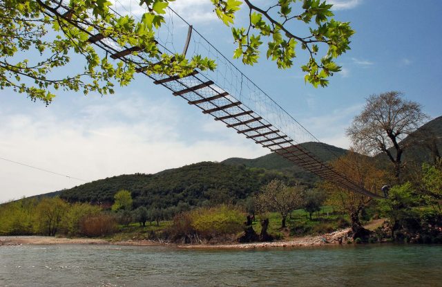
The gorges of the northern side are used for canyoning. Eleven of them have fixed safety equipment, for trained people or groups with a guide. At the village of Pavliani, on the southern side, a recreation park has wooden bridges, swings and easy paths beside the springs of the Asopos river.


History & Culture
In Greek myth, Heracles died on Oeta. He built his own funeral pyre on the mountain. The ancient Greeks honoured him at a place now called the Pyre of Heracles, at the entrance of the Katavothra plateau, above the villages of Pavliani and Pyra. Visitors find the remains of a Doric temple and a stoa from the 3rd century BC, and an altar that was used from Archaic to Roman times. A forest road passes beside the site.
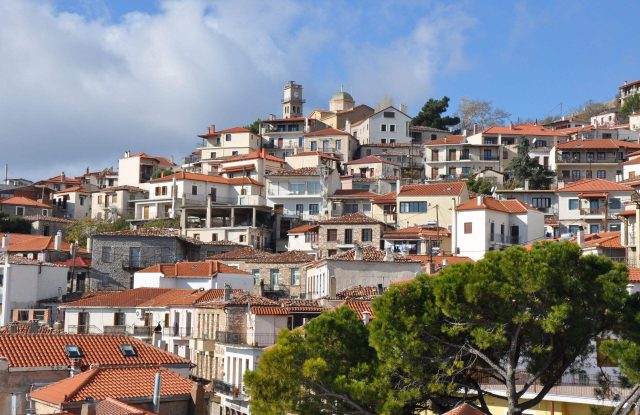
Ypati, a small town on the northern side, has a medieval castle on the rock above it. Three kilometres to the west, the Agathonos Monastery dates from the 15th century and houses a natural history museum of Oeta. At the eastern foot of the mountain, Greek resistance fighters and British saboteurs blew up the railway bridge of Gorgopotamos in November 1942. It was rebuilt after the war.


Practical information
Getting there
Oeta has two sides with different approaches, so choose the side before you set off. For the northern side, drive to Ypati, a small town about 25 kilometres west of the city of Lamia and about 230 kilometres from Athens. The villages of Kastania and Neochori are higher up on the same side. For the southern side, drive to Pavliani, a village about two and a half hours from Athens, or to the village of Pyra. The southern villages are closer to the plateaus.
Getting around
Asphalt roads reach the villages. Above them, earth forest roads lead to the plateaus: from the villages of Kastania and Neochori on the northern side, and from the villages of Pavliani and Pyra on the southern side. Their condition changes with the season, and a high-clearance or 4×4 vehicle is the safe choice. One of these roads passes the ancient sanctuary named the Pyre of Heracles and reaches the Katavothra plateau. In winter, snow can close them. Everything else on the mountain is reached on foot.
When to go
Spring and early summer are the time for the wild flowers and for the ponds on the plateaus, which hold water for part of the year only. In summer the high ground is cooler than the plains below. In winter it is under snow. The forest roads may be closed then, and the climbs from the northern side become winter mountaineering routes for experienced people only.
Good to know
Do not count on the mountain refuge at Trapeza for a night: ask the mountaineering club of Lamia whether it is open. Other places to stay are in the villages, mainly the small town of Ypati and the village of Pavliani. There are springs on the path from Ypati to the refuge. Pavliani receives many visitors at weekends, so go on a weekday if you want its park and paths to be quiet.
Mount Oeta (Oiti)— been there?Tell others what you saw.
A photo and two lines are enough.