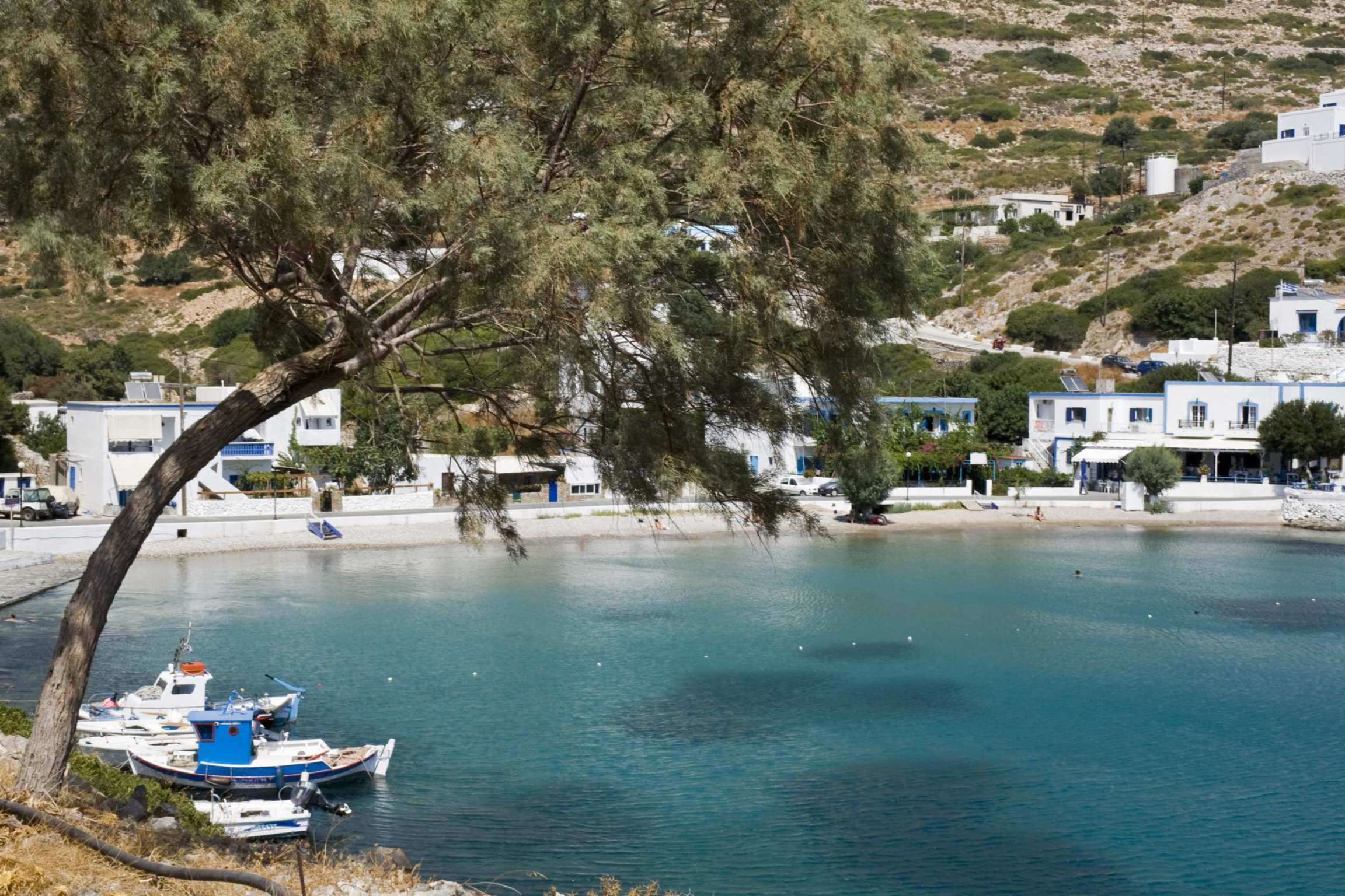
Agathonisi is the most northern island of the Dodecanese. It covers thirteen square kilometres of limestone and thorny scrub, and it lies about eight kilometres off the Turkish coast.
Around two hundred people live here, in three settlements. One is the harbour at Agios Georgios. The other two are villages built inland, where they cannot be seen from the sea — protection against pirates, which was still needed in the nineteenth century.
The island has one shop, three tavernas, no bank and almost no traffic. It also has a Hellenistic naval station on the north coast, five caves, a scattering of chapels, and a coastline of small beaches with no facilities, reached on foot along old donkey paths.
History & Culture
Thucydides and Strabo call the island Tragea, the goat island. It belonged to a group known as the Milesian islands, together with Leros, Lipsi and Patmos.
At Kastraki, on the bay of Maistros in the north, archaeologists excavated between 2006 and 2010 and found a fortified harbour of the late fourth and early third centuries BC. It was garrisoned by Miletus and surrounded by walls almost two metres thick.
The site is built on three terraces. At the top is a tower. Below it is a sanctuary to Didymaean Apollo and to eastern gods. On the lowest level are workshops for purple dye and a very large beekeeping installation.
The hives make this site unusual. Archaeologists recovered hundreds of ceramic vessels, of both the horizontal and the vertical type, together with extension rings. This is honey production on a scale far larger than the island itself could have used. One broken piece may carry the word kypselion, the term Aristotle uses for a hive. If so, it is the first time that word has been identified in an archaeological find.
East of Megalo Chorio stand the Tholoi: vaulted stone buildings of the eleventh century. For generations islanders used them as animal shelters, before anyone realised what they were.
Nature & Outdoors
There are almost no cars here, and people move around the island on foot. Stone paths connect the harbour to both villages and continue out to the coves. You can cross the whole island in an afternoon, and the highest point is only 209 metres, near Mikro Chorio.
The island and the uninhabited rocks around it are part of the Natura 2000 network, protected for the seabirds and birds of prey that nest there.
Wild goats live everywhere and are not afraid of people. At Spilia they come down to the shore in the afternoon and drink from the sea.
Five caves are scattered around the coast. In earlier centuries people hid in them during raids. Two of them, at opposite ends of the island, are said locally to be connected by underground passages.
Beaches
None of the beaches on Agathonisi are organised. There are no sunbeds, no bars, and no shade except from the trees.
Spilia is the easiest to reach: twenty minutes on foot from the harbour, along the coast. It has sand, fine pebbles, and tamarisk trees leaning over clear water.
Agios Georgios, at the port itself, is the only beach with anything nearby.
Southeast of the villages, Poros is sandy and very shallow, with an open cave in the rock at one end. Vathy Pigadi, named after the deep well beside it, has pebbles and is reached by a dirt track through a goat paddock.
Tsangari lies beyond the chapels east of Megalo Chorio. Gaidouravlako is the most isolated of all, reached on foot or by boat.
Take water and food with you. There is nothing at any of them.
Food & Drink
There are three tavernas, and what they serve depends on what the boats brought in that morning: fish and octopus from the sea, and goat from the hills, usually stewed with pasta. They also make small myzithra pies with cheese produced on the island.
Honey is the thing to take home, and it has a very long history here. The installation at Kastraki shows that Agathonisi was producing honey commercially more than two thousand years ago. The thyme and thorny scrub that make the landscape look bare are exactly what the bees need.
Where to Stay
Prices shown per night for a sample 3-night stay. Rates and availability vary by season — select your dates for live pricing.
Practical information
Getting there
Agathonisi is not on the way to anywhere. Ferries connect it to Samos, which takes about an hour and is the shortest and most reliable route. There are also boats to Patmos, Lipsi, Leros and Kalymnos, and to Piraeus on the long Dodecanese line, which takes eight hours or more. Boats do not run every day, and there are far fewer of them outside summer. The nearest airport is on Samos, one hour's flight from Athens.
Getting around
You walk. Stone paths link the harbour with Megalo Chorio — uphill, about twenty minutes — and with Mikro Chorio. There is no bus and no car hire. A few pickup trucks and taxis can be arranged through your accommodation. Do not bring a car. If you need one for the rest of your trip, pick it up on Samos or Kos and leave it there.
When to go
June to September. Outside these months there are very few ferries and most rooms close. July and August are the busiest, which on Agathonisi means that everything is full rather than that it feels crowded. There are few beds, so book well ahead. Chapel festivals take place through the summer, and the largest is in late July.
Good to know
There is no bank and no cash machine, so bring cash. The island has one shop, three tavernas, a bakery and a health clinic. Much of the accommodation is never listed on booking sites and is arranged by phone. Mobile signal is weak inland. Many people come as a day trip from Samos or Patmos, but the island is very different once the day boats leave — that is the reason to stay the night.
Agathonisi Island— been there?Tell others what you saw.
A photo and two lines are enough.
