
Lemnos lies in the northern Aegean, closer to Turkey than to Athens, in the North and East Aegean island group. It looks nothing like the islands most visitors imagine. It is wide and low, with more farmland than mountains: wheat fields and vineyards run down to a coast of long open beaches.
Volcanic rock gave the island some unusual features — a small desert of moving sand dunes, salt lakes that fill with flamingos, and a petrified forest. Lemnos also has Poliochni, a Bronze Age settlement that many archaeologists call the oldest city in Europe.
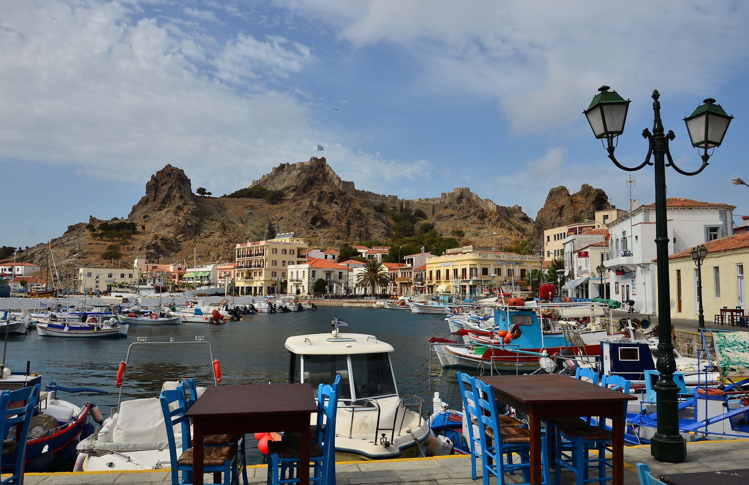
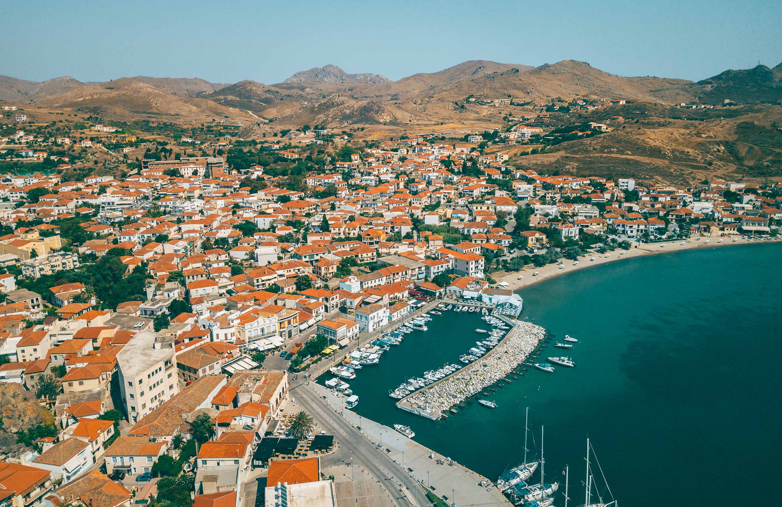
Myrina, the capital and port, spreads out on either side of a rocky headland with a Byzantine castle on top, where fallow deer still live. Its two bays are lined with large neoclassical houses, built by islanders who made money in Egypt. Tourism here has stayed small.
History & Culture
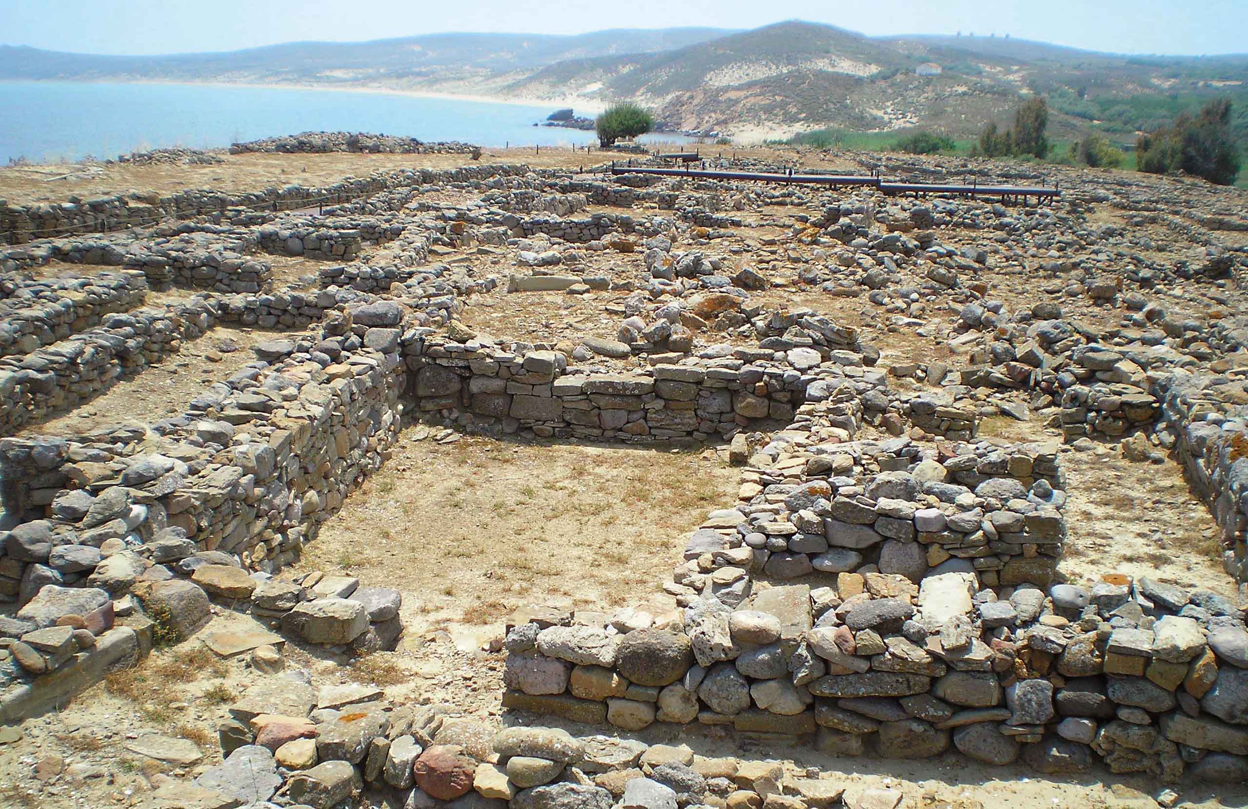
Poliochni stands on the east coast, facing Troy. Many archaeologists call it the oldest city in Europe.
It was already a planned settlement in the Early Bronze Age, with paved streets between the houses, public buildings, and a hall with stepped seating. Some researchers read that hall as the earliest physical evidence of group decision-making in Europe.
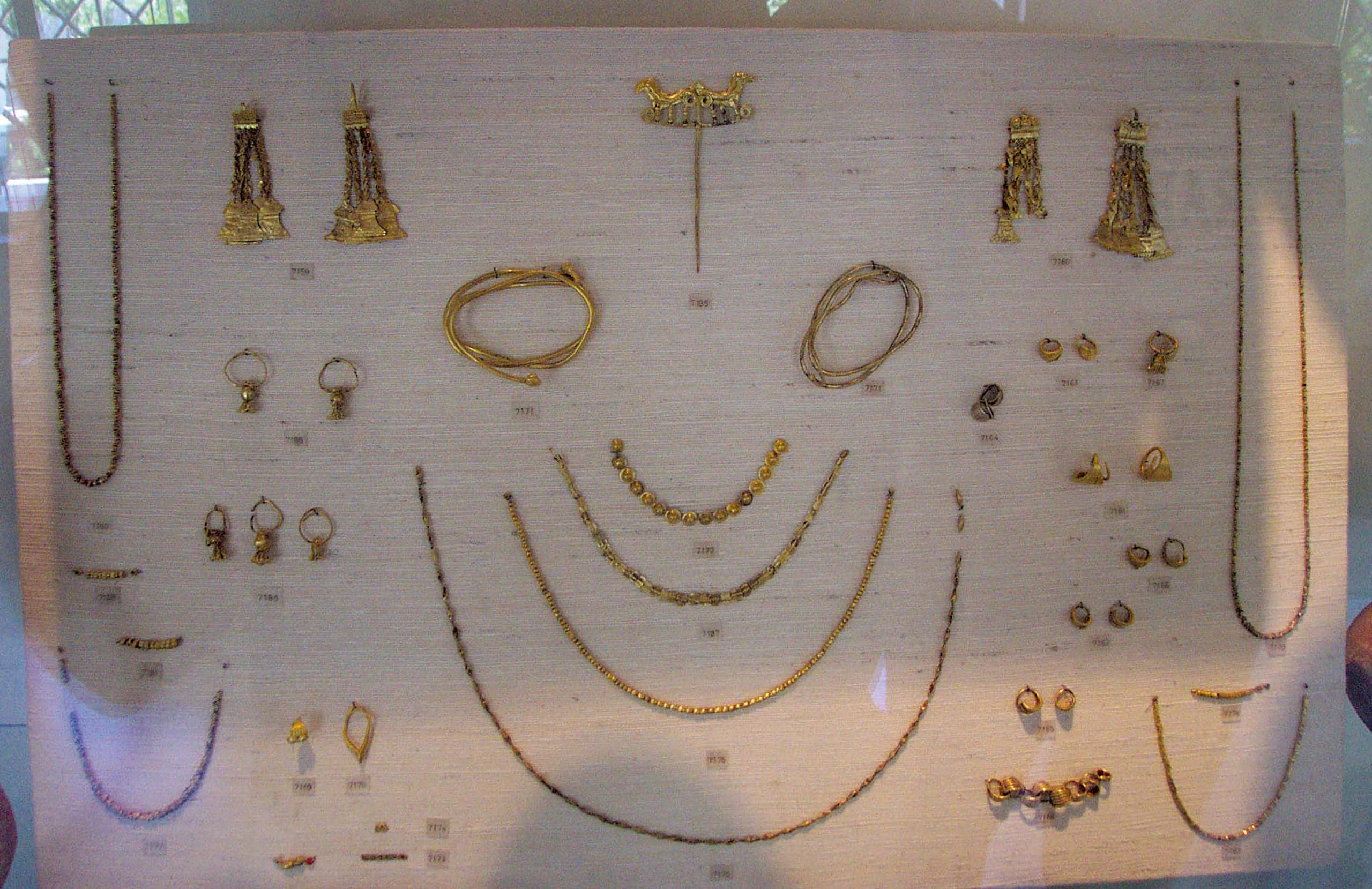
The site reopened after a large restoration covering 22 blocks of buildings, with new walkways and information panels. Its famous gold treasure is now kept in Athens.
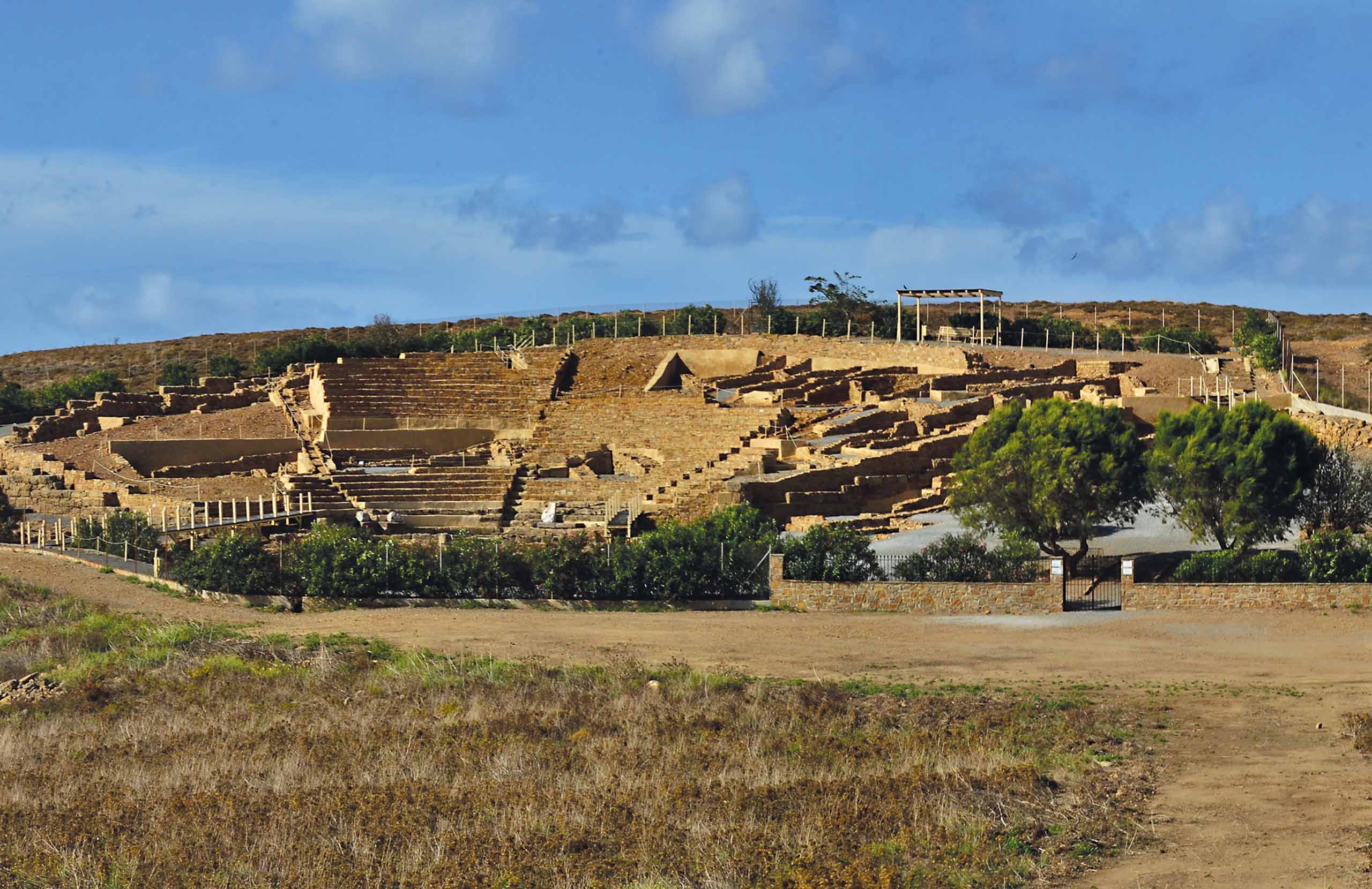
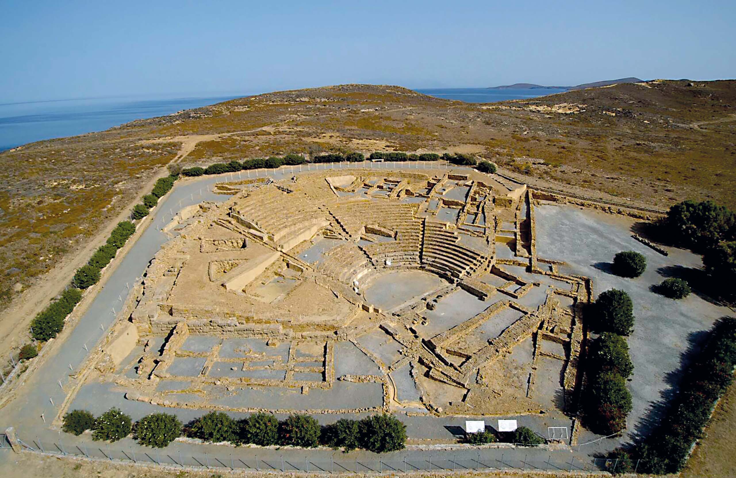
Hephaestia, on the bay of Pournias, was the most important ancient city on the island and the centre of its religious life. It is named after the god Hephaestus, who according to myth kept his forge here. Its Hellenistic-Roman theatre has been restored and stands in open countryside above the sea.
Nearby is the Sanctuary of the Kabeiroi, where secret religious ceremonies took place. People travelled from all over the Greek world to take part.
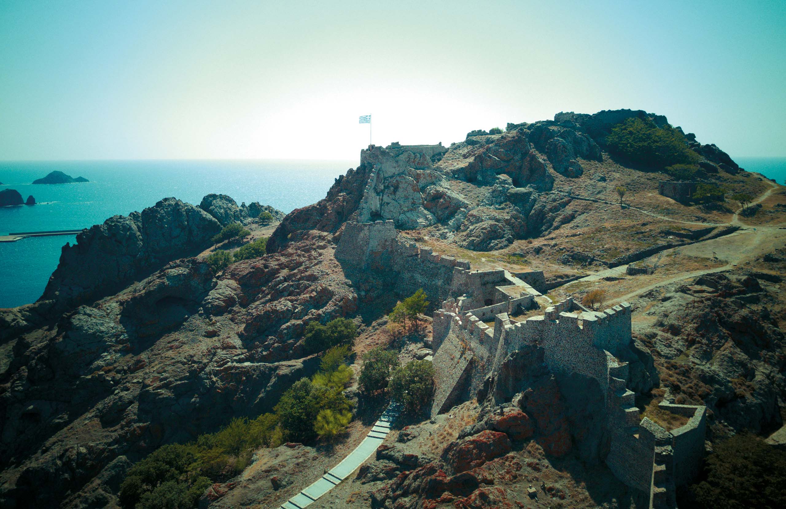
Above Myrina, a Byzantine fortress spreads across a rocky headland. It was begun in the late 12th century and later rebuilt by the Venetians. About two hundred fallow deer, brought from Rhodes in the 1970s, now live inside and below its walls.
Food & Drink
Lemnos is flat and fertile in a way that most Aegean islands are not, and the food comes from farming rather than fishing.
The island grows wheat and barley, including an old variety called mavragani, which is milled into a dark, heavy flour. From it comes flomaria, hand-cut egg pasta traditionally served with rooster.
Kalathaki Limnou is a white cheese kept in brine and drained in small wicker baskets, which leave their pattern on the rind. It has PDO status — a European protected origin label — and so does the island's wine.
The volcanic soil suits Muscat of Alexandria, grown around Atsiki, Moudros and Nea Koutali. The island also grows Limnio, one of the oldest recorded red grape varieties anywhere. A large part of the vineyards are farmed organically.
Beaches
The island divides in two.
The west coast, close to Myrina, has the organised beaches. Riha Nera and Romeikos Gialos are within walking distance of the town, both with sunbeds, bars and lifeguards. Plati lies two kilometres out and runs for about 700 metres of fine yellow sand. Further south, Thanos and Evgatis are wider and quieter — Evgatis is nearly two kilometres of pale sand with open countryside behind it. Several of these beaches have Blue Flag status, and a few have Seatrac ramps for swimmers with limited mobility.
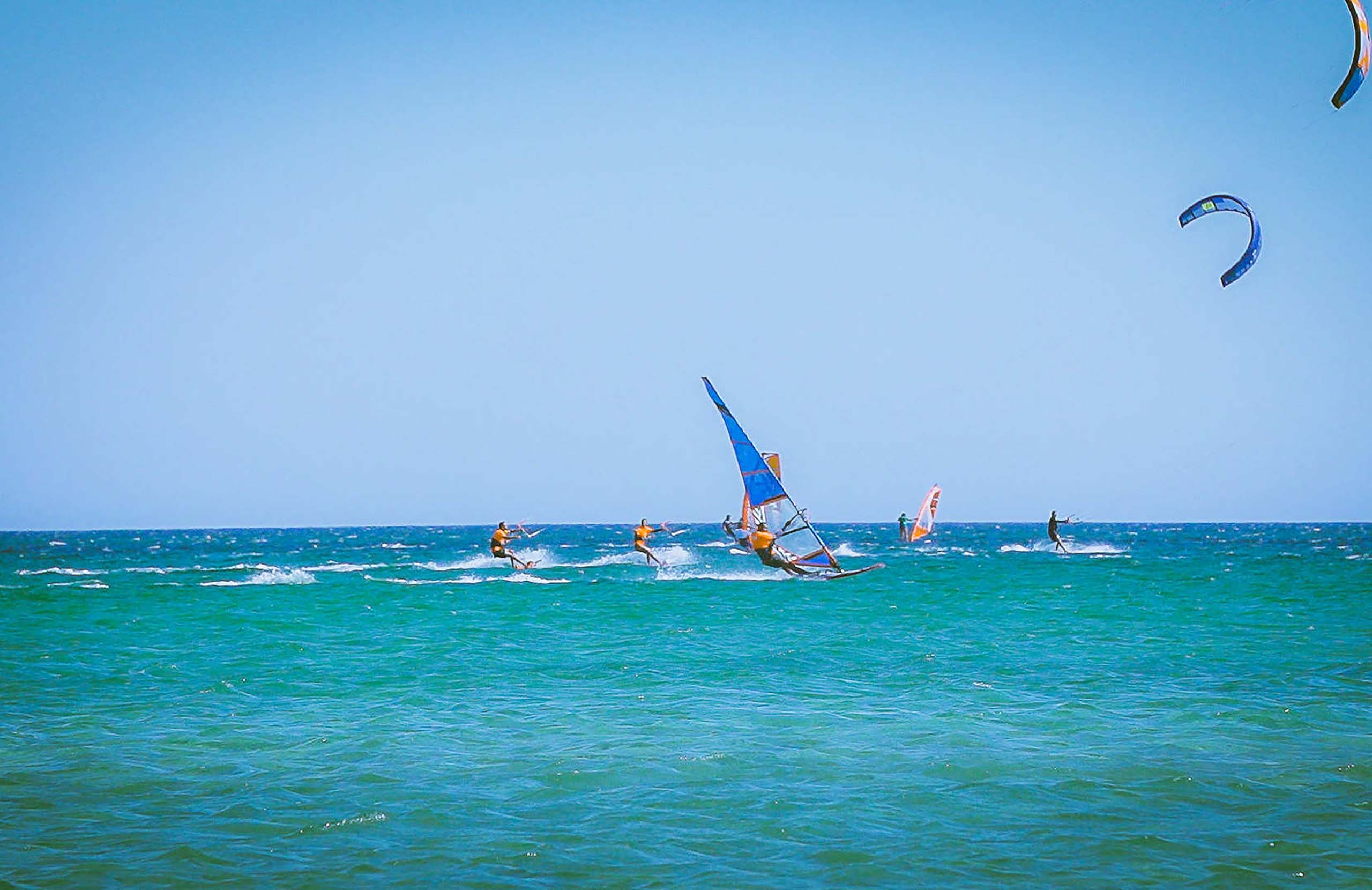
The east and north coasts are emptier and windier. Keros is a shallow bay that faces the summer winds directly, and it has become one of the more reliable windsurfing and kitesurfing spots in the Aegean, with schools open through the season. Zematas is reached by dirt road and is worth the effort at sunset. Gomati lies below the dunes, exposed and often deserted.
Nature & Outdoors
Lemnos has almost no mountains. Its landscapes were made by wind, water and old volcanic rock.
The dunes
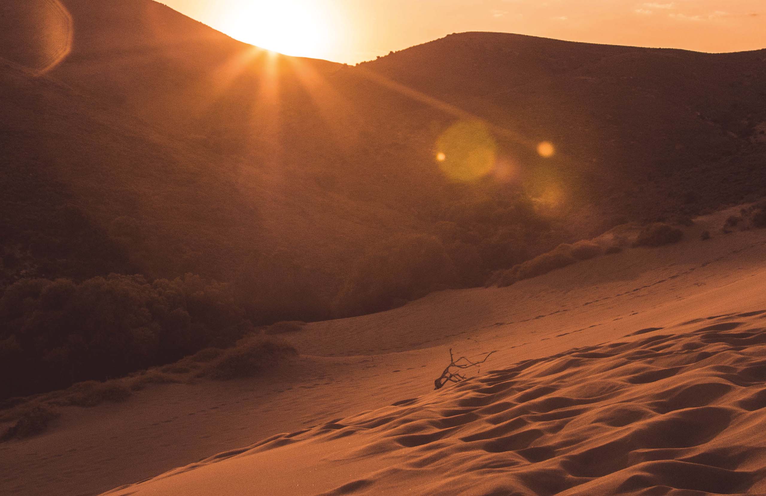
In the north, past the village of Katalakko, the Ammothines are a field of moving sand dunes covering about seventy stremmata. It is a stretch of desert a short walk from the sea. Gomati beach lies immediately below.
Fossils
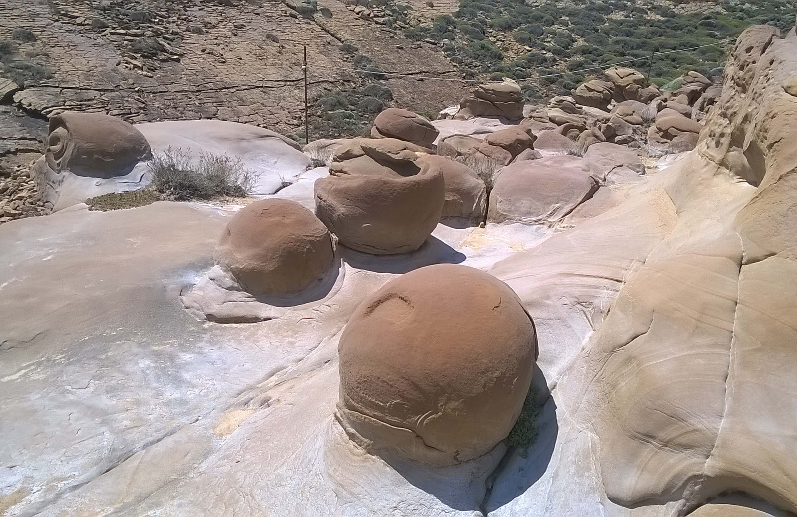
Fossil sites are scattered across the island. There is a protected petrified forest with tree trunks about 23 million years old. Outside Varos, a fenced sequoia trunk more than seven metres long lies in the fields. In eastern Lemnos there are even older fossil traces preserved in sedimentary rock.
The wetlands
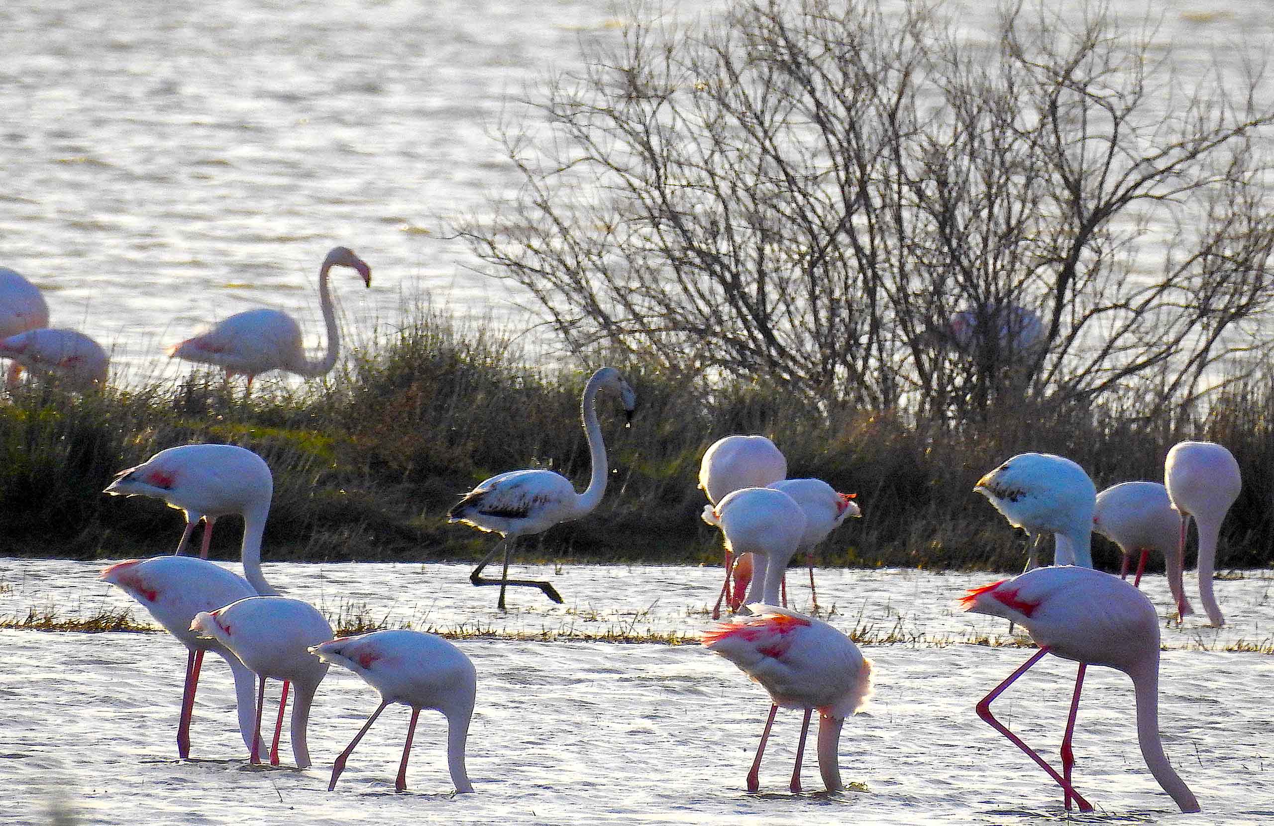
Lake Aliki, near Kontopouli, is said to hold the largest seasonal gathering of flamingos in Greece. Nearby, Chortarolimni and Asprolimni dry out completely in summer and fill again with the autumn rains. These places are for birdwatching rather than walking.
Activities
The meltemi wind makes Lemnos uncomfortable for some visitors, and it is exactly why others come. From May to October it blows steadily from the north and northeast, usually at four to six on the Beaufort scale.
Keros Bay has built a small industry around it. There are windsurfing and kitesurfing schools with equipment to rent, rescue boats, and lessons for children from about five years old. You can also try wingfoiling, paddleboards and small sailing dinghies.
Diving is the alternative on calm days. PADI centres operate at Keros and at Evgatis on the south coast. They run introductory dives, certification courses and guided trips to underwater pinnacles, small caves and reefs a few minutes from shore.
Inland, the island is flat, which makes it unusually good for cycling. Bikes and e-bikes are easy to find, and the distances between villages are manageable. Organised trips also go to the dunes, the salt lakes and the wineries.
Where to Stay
Prices shown per night for a sample 3-night stay. Rates and availability vary by season — select your dates for live pricing.
Practical information
Getting there
Lemnos has an airport 22 km east of Myrina. Flights from Athens take under an hour, and there are also connections to Thessaloniki and to several Aegean islands. Ferries are slower but cheaper. The crossing from Kavala in northern Greece takes three to four hours. The route from Lavrio, near Athens, is an overnight journey. Ferries run often in summer and much less often in winter, so check current timetables before you fix your dates.
Getting around
You will want a car. The island is large, the villages are far apart, and the main sights are spread out. The roads are asphalted and generally good, with some exceptions: the dunes at Ammothines are reached by a signposted dirt track from Katalakko, which needs slow driving. Public buses connect Myrina with the villages, but there are few of them, and they do not reliably match flight or ferry times. Taxis are based in Myrina.
When to go
The season runs from May to early October. July and August are the warmest and busiest months, and also when the meltemi blows hardest from the north. This is excellent if you have come to windsurf, and less good if you want calm water. June and September are gentler. Moudros holds a sardine festival in August, and the village of Kalliopi holds horse races each April, for the feast of Saint George.
Good to know
Distances are longer than they look on the map. Bring water, a hat and sunscreen to the dunes — there is no shade at all. Archaeological sites usually close in the early afternoon, so visit in the morning. Tap water is safe to drink in Myrina. Carry cash outside the main towns.
Lemnos— been there?Tell others what you saw.
A photo and two lines are enough.
