Evinos River
- Canoeing-Kayaking, Lakes, Rafting, Rivers
- Geo Area: Central Greece


The Evinos rises in the Vardoussia mountains near the village of Artotina, in Phocis, and runs some 92 kilometres southwest through mountainous Nafpaktia and Central Greece before reaching the Gulf of Patras near Missolonghi. A dam partway down its course holds back a reservoir that feeds, by way of an underground tunnel almost 30 kilometres long, the Mornos reservoir that supplies Athens with drinking water — an unusual role for a river most visitors have never heard of. Around the reservoir itself, the area stays quiet even in summer, and the river’s middle stretch is where whitewater rafting operators run their trips through the year.
Geography
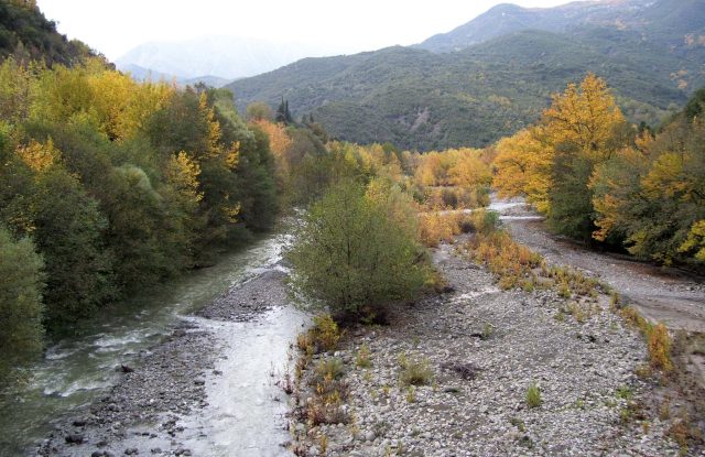
Locally the river is still sometimes known by an older name, Fidaris — "snake river" — alongside the official Evinos. From its source near Artotina, in the Vardoussia range, it drops through forested gorge country before opening into wider valleys as it nears the coast, over some 92 kilometres from source to sea.
Partway down its course, a dam completed in 2001 holds back a reservoir covering close to four square kilometres, with a wall over 100 metres high. Most of the water never continues downstream: it is diverted through an underground tunnel almost 30 kilometres long to reinforce the Mornos reservoir, part of the system supplying Athens with drinking water. The river reaches the sea at the Gulf of Patras a short distance from Messolonghi, near the village of Evinochori, which takes its name from it.
History & Culture
In mythology, the river carried a different name before it carried this one. Evenus, a river-god of ancient Aetolia, chased his daughter Marpessa after the hero Idas carried her off; when his chariot failed to catch them, he drowned himself in the river then known as Lykormas, which was renamed in his memory.
On its right bank, close to where the river meets the sea, stand the remains of ancient Kalydon — once the largest religious centre on this stretch of coast, and the source of the myth of the Calydonian Boar Hunt. A sanctuary to Artemis and Apollo, a theatre that seated around 6,400 people, and an underground burial chamber with marble sarcophagi are all still standing, and the site is open daily for a small entrance fee.
Nature & Outdoors
Above the reservoir, the valley narrows into forested gorge country, with the river cutting between the slopes of the Vardoussia range and the wider uplands of Nafpaktia — a quieter, greener landscape than most visitors picture when they think of this part of Greece.
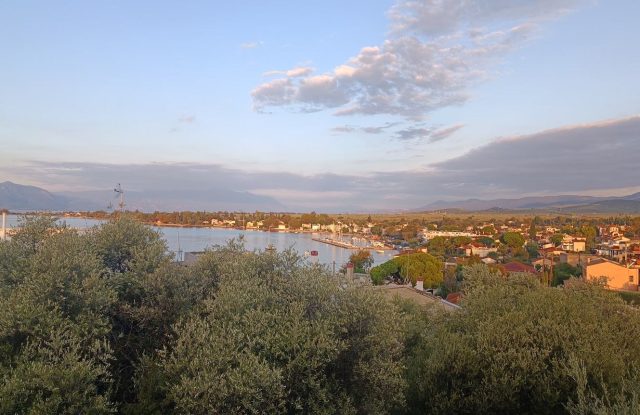
Near its mouth, the river spreads into a wetland delta on the edge of the Missolonghi-Aitoliko lagoons, one of the Mediterranean's larger lagoon systems and Ramsar-protected since 1975. The birdlife that draws visitors to the wider lagoon complex extends along this stretch of coast, though the delta itself has no dedicated observation point of its own.
Activities
Rafting is the river's best-known activity, run on a stretch between the bridges of Poros and Bania and graded as easy-to-moderate (class II) rapids. Several operators run trips based around Nafpaktos, typically lasting about three hours across most of the year; because flow depends on rainfall and on releases from the dam upstream, water levels vary by season and it's worth checking conditions before setting out.
Kayaking is offered on the same stretch, and the reservoir upstream draws a different, calmer crowd: walking and mountain-biking routes ring its shore, and it is fished and visited by people well beyond the surrounding villages, with local festivals held in the lakeside settlements through the year.
Practical information
Getting there
The most common approach is via Nafpaktos, around two and a half hours' drive from Athens on the coastal road, or a short drive across the Rio-Antirrio bridge for anyone coming from Patras or the Peloponnese. From Nafpaktos, mountain roads lead north into Nafpaktia towards the reservoir and the rafting bases; there is no direct public transport into the valley itself, so a car is effectively required.
Getting around
Once off the coastal road, the valley is served by narrow mountain roads rather than a single through route, and the reservoir, the rafting bases and the surrounding villages are spread out rather than clustered together. Artotina, near the source, and the villages around the reservoir sit well apart from each other in the hills, so distances that look short on a map can take a while to drive. Signage is inconsistent, and a GPS or offline map is more reliable than road signs alone.
When to go
Spring brings the highest water levels, right after snowmelt and the winter rains, and is generally the most reliable time for rafting; by late summer, low flow can suspend trips altogether, so it's worth checking with an operator before planning a visit around the activity specifically. The reservoir and the surrounding hills are pleasant for walking through most of the year, though mountain roads can be affected by snow in winter.
Good to know
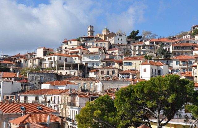
This is a quiet, agricultural and forested corner of Central Greece rather than a developed tourist area — expect small guesthouses and family-run tavernas in the villages rather than resorts, and little infrastructure at the dam or the delta itself. Because the reservoir and the river's middle stretch are managed for water supply and hydropower rather than tourism, water levels and appearance can change noticeably between visits.
Evinos River— been there?Tell others what you saw.
A photo and two lines are enough.