
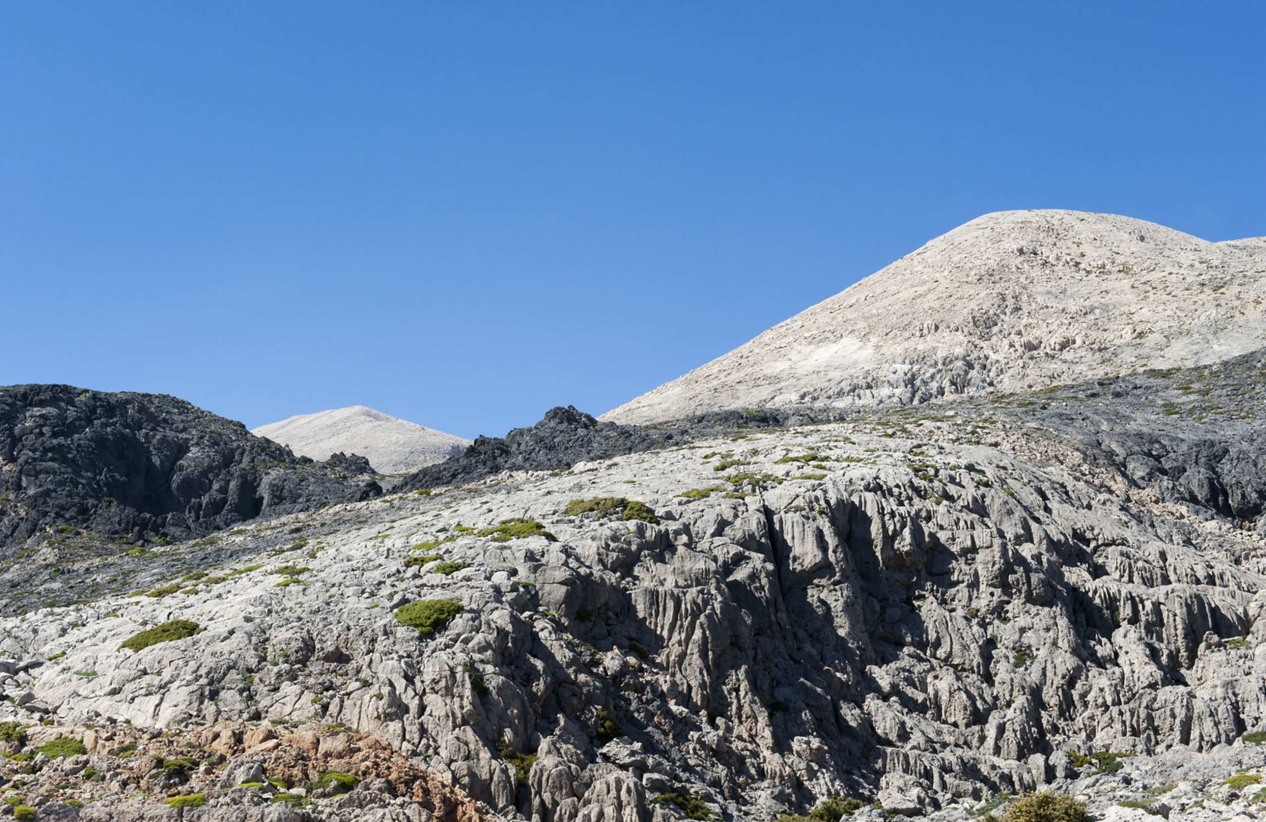


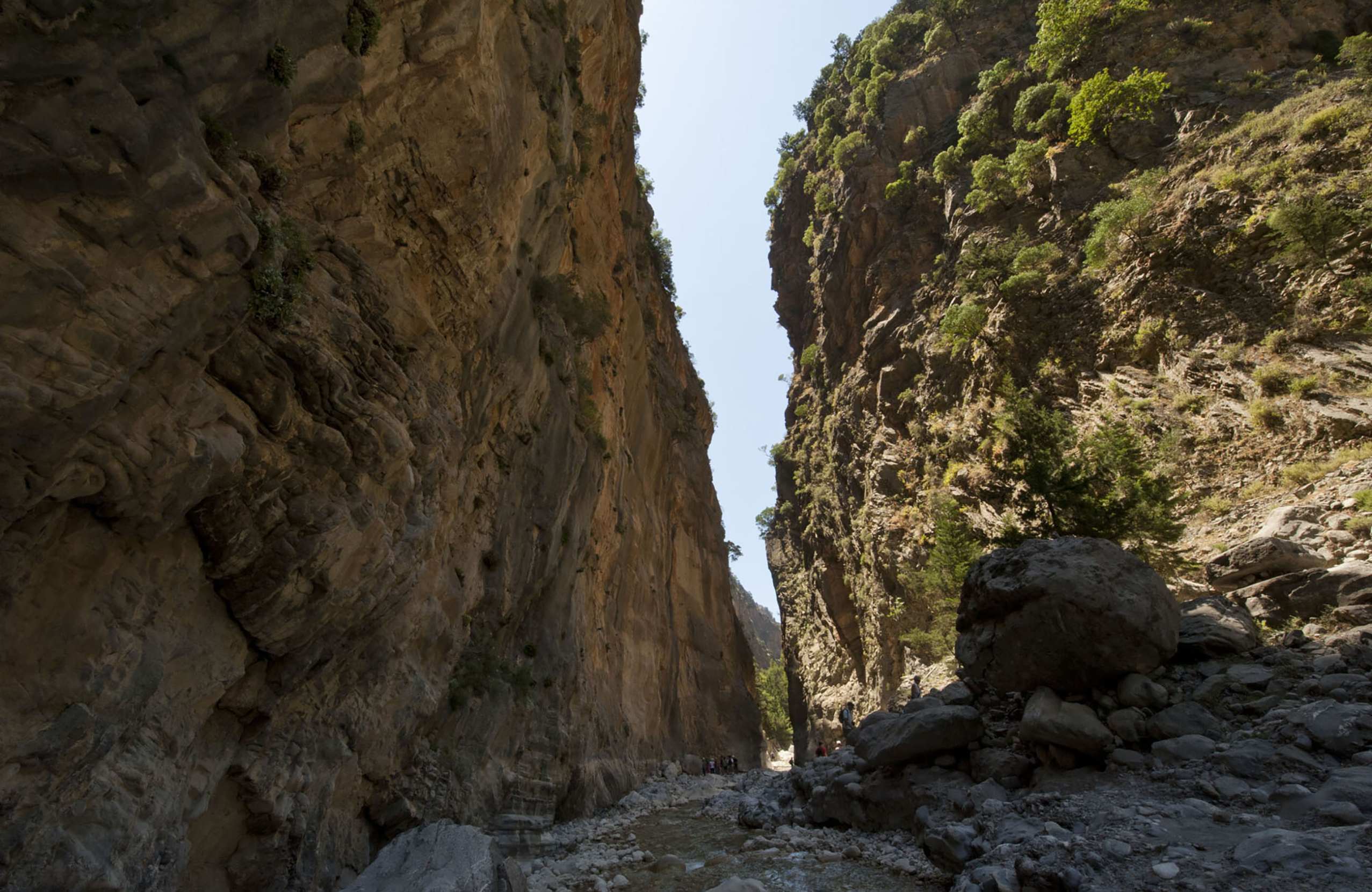


The White Mountains, called Lefka Ori in Greek, rise south of the city of Chania and cover much of western Crete. Their highest peak, Pachnes, reaches 2,453 metres. The upper part is a desert of pale limestone, white with snow in winter. About fifty gorges cut through the mountains towards the south coast. The best known is the Samaria Gorge, a national park that thousands of people walk every summer. Others, such as Imbros and Agia Irini, are shorter and quieter. Walkers also come for the marked paths to the peaks, the mountain refuges and the long E4 trail. The wild goat of Crete, the kri-kri, lives here. Most people start from Chania, from the plateau of Omalos or from the small harbours of the south coast.
The White Mountains fill the centre of western Crete, south of the city of Chania. The rock is limestone. It is pale grey in summer and covered with snow from winter until late spring, and this gave the mountains their name.
The highest peak is Pachnes, at 2,453 metres, the second highest in Crete after Mount Ida. Dozens of other peaks pass 2,000 metres. The central part, above about 1,800 metres, is a high desert of bare rock, with cone-shaped summits, hollows between them and very little vegetation.
About fifty gorges cut through the mountains, and most of them run south to the Libyan Sea. On the lower slopes lie several plateaus surrounded by peaks, among them Omalos, Askifou and Anopoli, at heights between about 500 and 1,200 metres. Under the mountains, cavers have explored two caves that go more than a kilometre deep.
Most visitors come for this walk. The path is 16 kilometres long and goes one way, from Xyloskalo, at about 1,230 metres on the edge of the Omalos plateau, down to the village of Agia Roumeli on the south coast. It takes four to seven hours. The gorge is a national park with an entrance ticket, open from about May to October.
Imbros, about 8 kilometres long, is the easiest and takes two to three hours. Agia Irini, about 7.5 kilometres, is green and shaded and ends a few kilometres from the coastal village of Sougia. Aradena is shorter and rougher, for experienced walkers.
A marked path climbs from Xyloskalo to the peak of Gingilos, at 2,080 metres, in about five hours there and back. Pachnes is climbed from the village of Anopoli: a rough dirt road ends at about 1,950 metres, and the summit is up to two hours further on foot. The European E4 trail crosses the high desert from refuge to refuge. In the gorge of Theriso, near Chania, there are about a hundred bolted climbing routes.
The Samaria Gorge has been a national park since 1962, and UNESCO named it a biosphere reserve in 1981. The park was created partly to protect the kri-kri, the wild goat of Crete, which lives on the cliffs of the gorge and in the mountains around it. The animals are shy. Walkers sometimes see them on the rocks early in the morning or towards evening.
The gorges and lower slopes have old forests of cypress and pine, and the path through Samaria goes down through them. Higher up the trees stop and the ground is bare rock. About a hundred plants that grow only in Crete are found in these mountains, and some of them grow nowhere else on the island. Griffon vultures are often seen above the cliffs, and the rare bearded vulture also lives here.
Theriso is 15 kilometres from Chania. The road to it runs for about six kilometres through a narrow green gorge. The village is known for its tavernas and for the revolt of 1905, which the Cretan politician Eleftherios Venizelos led from here. His headquarters is a small museum. The plateau of Omalos, 38 kilometres south of Chania at more than 1,000 metres, is the base for the Samaria Gorge, which starts at its southern edge.
This side is the district of Sfakia, in the south of the Chania area. The villages of the Askifou plateau lie on the main road to the south coast, and one of them, Kares, has a private war museum. Anopoli, on a plateau about 600 metres above the sea, has a statue of Daskalogiannis, who led the revolt of 1770 against Ottoman rule. Agia Roumeli, at the mouth of the Samaria Gorge, has no road and is reached only by boat or on foot.
The mountains are reached from Chania. Only a few roads go into the mountains. One climbs to the Omalos plateau and ends at Xyloskalo, the top of the Samaria Gorge, about 44 kilometres from Chania. Another crosses the Askifou plateau to Chora Sfakion, the small port of the south coast, about 70 kilometres from Chania. A short third road leads to the village of Theriso. In the walking season, morning buses run from Chania to Xyloskalo, and buses meet the boats at Chora Sfakion. Check the timetable before you go.
The gorge walks go one way, so plan the return before you start. No road reaches Agia Roumeli, the village at the bottom of the Samaria Gorge. Boats run from there to Chora Sfakion and to the villages of Sougia and Paleochora, and buses go back to Chania from those ports. The same boats stop at the village of Loutro. The dirt roads to the high ground, such as the one from Anopoli towards Pachnes, need a 4×4. Ask in the village about the state of the road and about a lift.
The Samaria Gorge is open only from about May to October. It also closes on days of heavy rain, even in summer, so check the day before. The Imbros and Agia Irini gorges are usually open all year, but any gorge is dangerous after rain. Snow stays on the high peaks until late spring and sometimes into June. In July and August the gorges and the high desert are very hot in the middle of the day, so start early. Spring and autumn are the most comfortable months for walking.
Carry water, sun protection and strong shoes. Inside the Samaria Gorge there is no food to buy until Agia Roumeli, and the park does not let walkers start the full route late in the day. Of the mountain refuges, Kallergi, at 1,680 metres above Omalos, has a warden and meals. Check with the mountaineering club of Chania which days it is staffed. The refuges in the high desert are simple shelters, opened on request, with no supplies. There is very little water on the high routes, so carry what you need.