
Vikos Gorge is a deep canyon in the Pindus mountains, in the Epirus region of northern Greece. It lies in Zagori, an area of stone villages, below the high peaks of Mount Tymfi. The main section is about 12 kilometres long, and its rock walls rise up to about 1,000 metres above the river bed. Near its northern end, springs start the Voidomatis River.
The best-known way to see the gorge is the long walk from Monodendri to Vikos village. Shorter walks lead to viewpoints at the edge of the gorge, where visitors look straight down. The gorge is part of Vikos–Aoos National Park, which protects the wildlife and plants of the mountains around it.
Geography
Vikos Gorge cuts through the Pindus mountains in northwest Greece. The main section is about 12 kilometres long and runs from the area of Monodendri in the south to Vikos village in the north. At its deepest, the walls rise about 1,000 metres above the river bed. At the bottom, the gorge narrows to only a few metres in places.
The mountains here were pushed up where the African and Eurasian plates meet. The rock is mostly limestone, with older dolomite in the deepest layers. The water of the Vikos stream cut the gorge, and the stream continues north as the Voidomatis River, which flows into the Aoos. The gorge is part of the Vikos–Aoos UNESCO Global Geopark.
Mount Tymfi rises beside the gorge and reaches 2,497 metres. Nearby, in the same national park, the Aoos River has cut a second gorge, about 10 kilometres long.

Nature & Outdoors
The gorge lies inside Vikos–Aoos National Park, which was created in 1973. More than 1,700 plant species grow in the park. Many are wild herbs that people have long used as medicine, such as mountain tea and St John's wort. Oak and juniper grow on the lower slopes of the gorge, and forests of black pine and beech cover higher ground in the park.
Brown bears, wolves, otters and Balkan chamois live in the park. It also has more than 150 bird species. Egyptian vultures, golden eagles and peregrine falcons are among the birds of prey recorded there.
Near the northern end of the gorge, the Voidomatis springs bring clear, cold water out of the rock and start the Voidomatis River. Higher up, the river bed is often dry, and it carries water mainly after rain or snow melt.


Activities
The main route is the walk through the gorge from Monodendri to Vikos village. It is about 12 kilometres long, and walkers should allow six to seven hours. The path goes down to the river bed, follows the bottom of the gorge, and then climbs steeply to Vikos village. Stone cairns and red paint mark the way, and a few short sections use cables or ropes for support.
A second route starts at Papigo and follows the north-west side of the gorge to the Voidomatis springs. It is about 6 kilometres long and takes four to five hours, with steep climbs and descents.
Two viewpoints show the gorge without a long walk. Oxia is reached by a short drive from Monodendri and a walk of a few hundred metres. Beloi is a walk of 20 to 30 minutes from the village of Vradeto.


History & Culture
In the 17th century, healers from Zagori began to collect medicinal plants in the mountains around the gorge. They were called Vikogiatroi, which means "doctors of Vikos". They travelled to treat patients in other places until the middle of the 19th century, when modern medicines arrived.
Agia Paraskevi Monastery stands at the edge of the gorge, a walk of about 15 minutes from Monodendri. It was built in the early 15th century. No monks live there now, but visitors can walk out to a terrace with a view over the gorge. During the Ottoman period, hermits and Christians who were in danger elsewhere took shelter in the caves of the gorge.
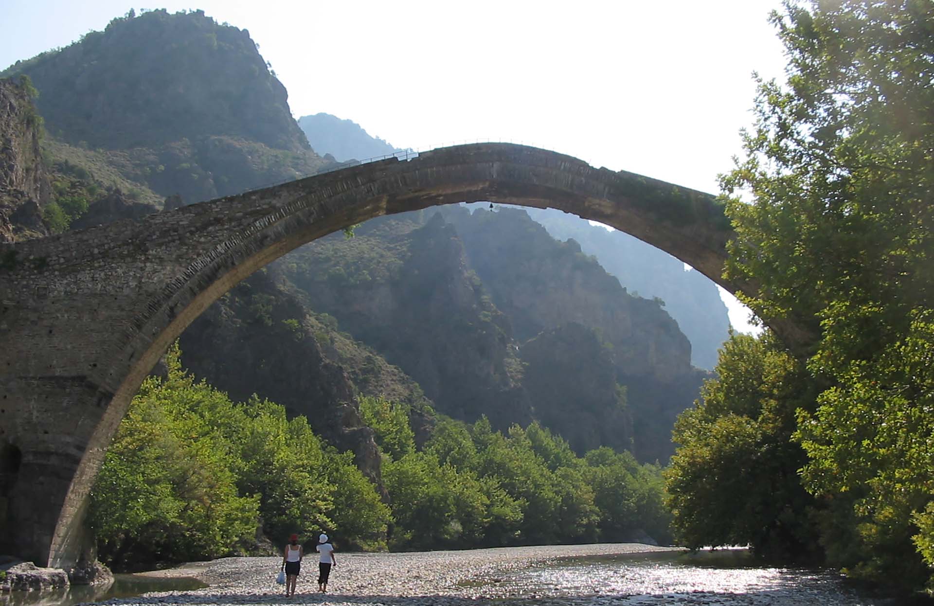
Stone paths, stairways and bridges link the villages of Zagori, an area that UNESCO added to the World Heritage list in 2023. The best-known stairway is at Vradeto. It was built in the 18th century, and until a road opened in 1974 it was the only way to reach the village.


Practical information
Getting around
The main walk is one way, so plan the return before you start. There is no public transport between Vikos village and Monodendri, so most walkers arrange a taxi in advance. The drive takes about 45 minutes. If you have a car, leave it at Monodendri and book the taxi from Vikos village to bring you back to it. Oxia has a car park at the end of a road, and Beloi is reached on foot from Vradeto.
Good to know
The river bed is often dry, so carry all the water you need. There are springs along the route, but do not rely on them. Start early, because the last part of the walk is in forest and gets dark quickly. The viewpoints have no railings, so stay well back from the edge. Camping and open fires are not allowed in the national park.
When to go
May to June and September to October are the best months. In April the slopes are green with wildflowers, and some snow can remain on the high peaks. Summers are hot, and afternoon thunderstorms are common from June to August. Rain makes the gorge dangerous, because rocks can fall from the walls. In winter, snow can close the roads to Papigo and Vradeto from time to time.
Getting there
Villages around the gorge are 40 minutes to one and a half hours by road from Ioannina. Monodendri is the start of the main walking route, and Papigo is the base for the north side. Buses from Ioannina serve villages such as these, but service is limited, so a car makes it much easier to reach the trailheads and viewpoints.
Vikos Gorge— been there?Tell others what you saw.
A photo and two lines are enough.
