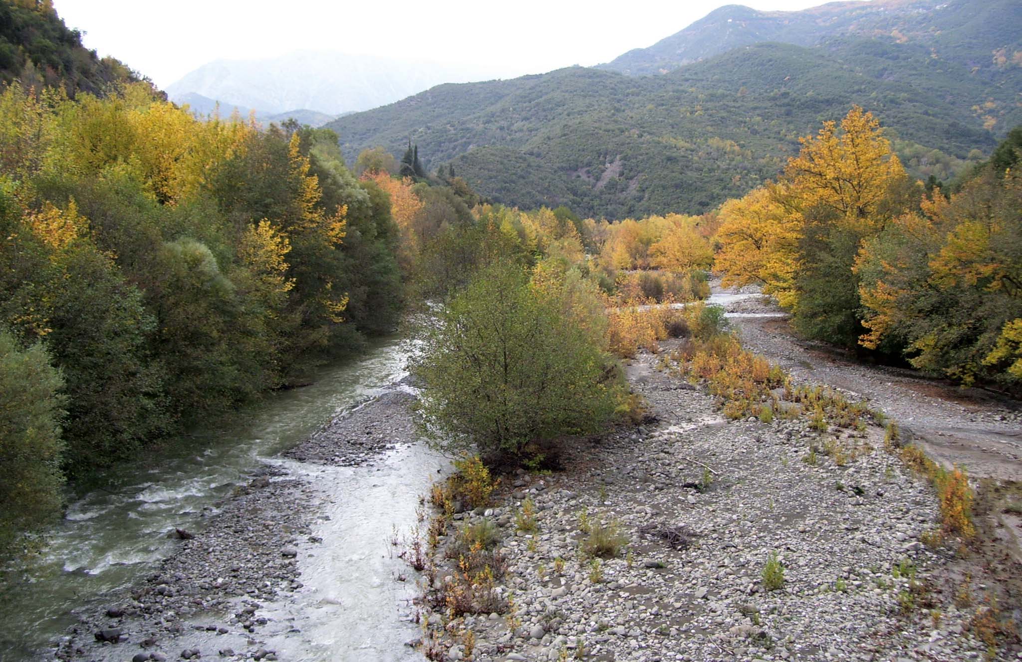
The Mornos River flows through the mountains of Phocis, in Central Greece, and a dam turns part of its valley into a large lake. The lake supplies Athens with drinking water. It lies between the Vardousia Mountains and Mount Giona, and a road goes all the way around its long arms. Under the water is the old village of Kallio, whose houses come back into view in dry years, and an ancient city once stood in the same place. Lidoriki, the main village of the area, looks over the lake and shows the finds from that city. Far from the lake, the river ends in a delta of fields and wetland on the Gulf of Corinth, near the town of Nafpaktos.
Geography
The Mornos rises on the south-western side of Mount Oeta, near the village of Mavrolithari, and is about 70 kilometres long. It first flows south through a narrow valley, with the Vardousia Mountains on its west side and Mount Giona on its east side.
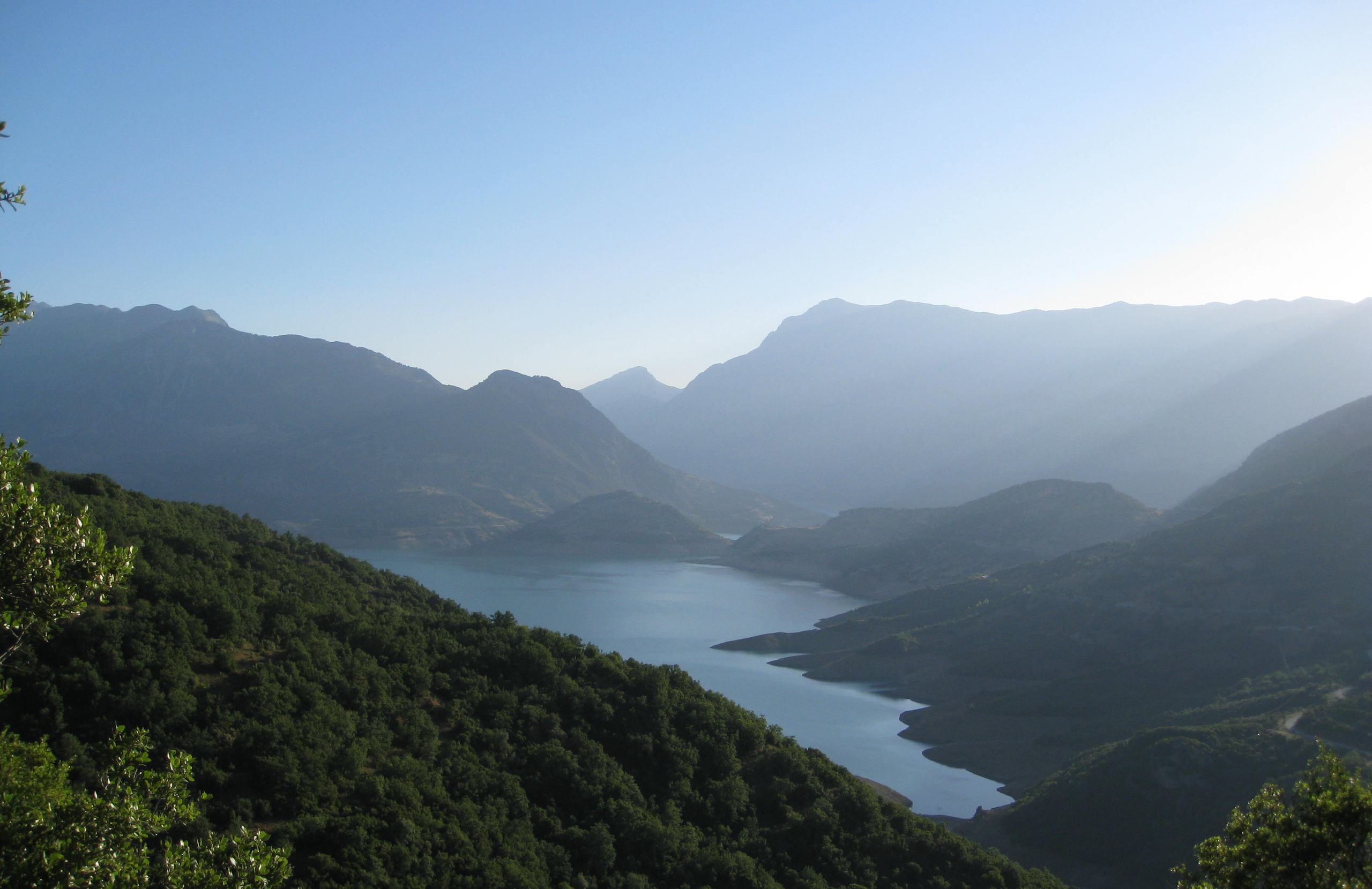
Further south the river enters Lake Mornos, a reservoir behind an earth dam about 125 metres high. The lake lies at an altitude of about 450 metres and covers about 15 square kilometres when it is full. A tunnel also brings it water from the Evinos River, further west.
Below the dam the river turns west through a deep valley with few villages, then south. Its last part is the border between two districts, Phocis and Aetolia-Acarnania. It reaches the Gulf of Corinth through a delta about 3 kilometres south-east of the town of Nafpaktos.
Nature & Outdoors
Lake Mornos
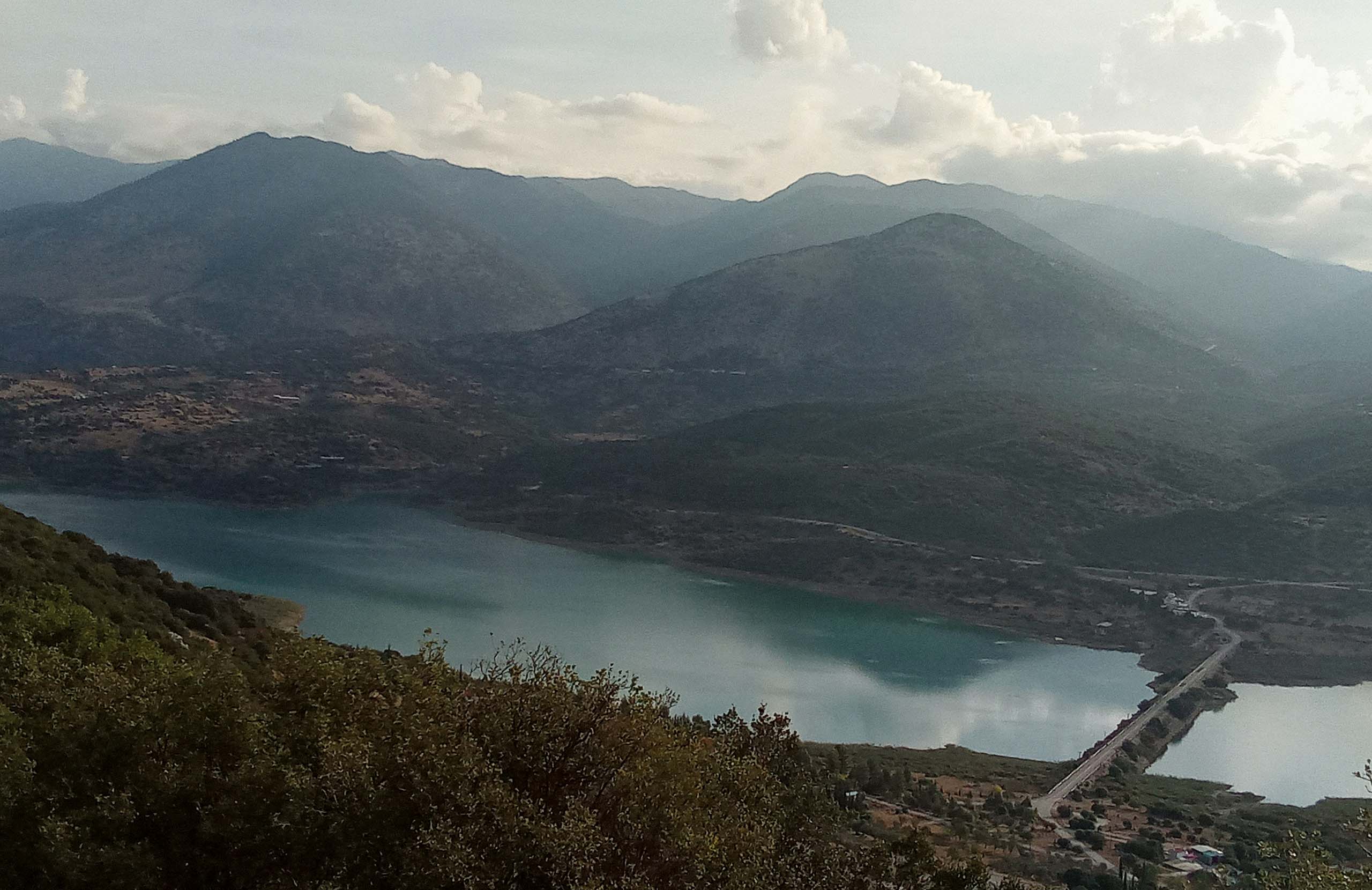
The lake fills several valleys between the mountains, so its shore has many long, narrow arms. At the narrowest point, called Steno, the two shores almost meet. An asphalt road of about 70 kilometres goes all the way around the lake, with views of the water, the Vardousia Mountains and Mount Giona. Oak, plane, willow and cypress trees grow on the slopes, and fir forest begins higher up. Eagles and other birds of prey fly over the lake.
The upper valley
North of the lake the road follows the river bed for several kilometres. Villages stand on both sides, under the cliffs of the two mountains.
The delta
At the coast the river has built a wide plain of fields and wetland, with a small lagoon beside the sea. Many birds stop here on migration. The village of Chiliadou, on the coast of the delta, has a sandy beach about two kilometres long.
History & Culture
The lake was made to give water to Athens. Work on the dam began in 1969 and ended in 1979, and an aqueduct more than 185 kilometres long carries the water east to the city.
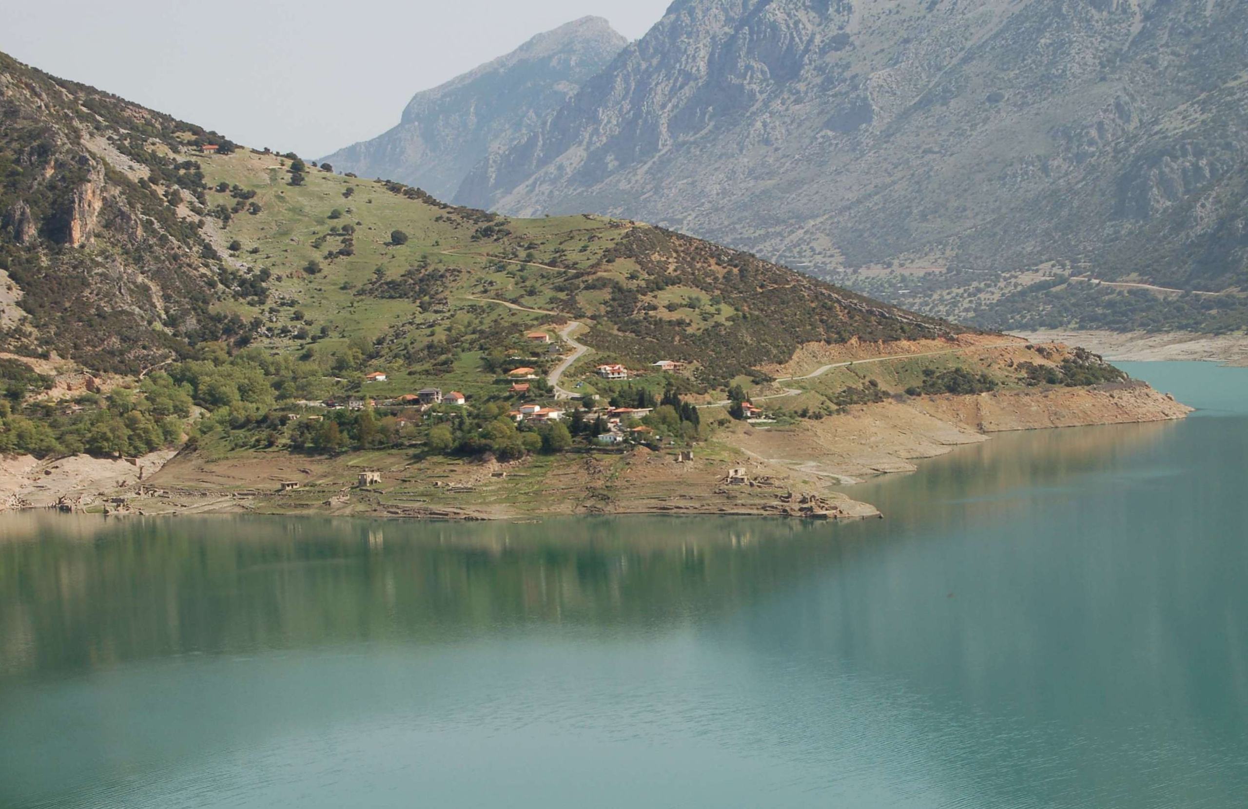
The flooded valley held Kallio, a village of about eighty houses. Its people moved to a new village of the same name, higher up the slope. The old houses are under water in most years. In dry years the lake falls far enough for their walls to come out, and this has happened several times since the early 1990s.
An older town stood in the same place. Ancient Kallion, also called Kallipolis, was a city of the Aetolians, and an army of Gauls destroyed it in 279 BC. It was excavated between 1977 and 1979, before the water rose. Parts of its walls stand on the hill above the lake, and the finds are shown in the village of Lidoriki.
Villages & Inland
Lidoriki is the main village of the area. It is on the lower slopes of Mount Giona, about five kilometres north of the dam, and looks across the lake to the Vardousia Mountains. Large plane trees shade its main square, and the bell tower of the church of Zoodochos Pigi rises above the houses. The village has two small museums: the Archaeological Collection, with the finds from ancient Kallion, and a folklore museum in a stone house.
Two more villages are in the upper valley, north of the lake. Sykia stands under the high cliffs of Mount Giona. Athanasios Diakos is on the opposite side, under the Vardousia Mountains. It is named after a hero of the Greek War of Independence of 1821, who by local tradition was born there.
Practical information
Getting there
The lake is reached through Lidoriki and the river mouth through Nafpaktos, so they are two separate trips. Lidoriki, the main village beside the lake, is about 245 kilometres from Athens and about 64 kilometres from Delphi. Another road comes from the north, down the upper valley of the river from the villages of Mount Oeta. The town of Nafpaktos is on the coast about 3 kilometres north-west of the river mouth, and a road bridge crosses the river there. The mountain roads are asphalt but have many bends.
Getting around
The road around the lake is asphalt, about 70 kilometres long and full of bends, so allow at least half a day for the whole circle with stops. It passes the dam at the southern end of the lake and the new village of Kallio at the northern end. Old Kallio lies below the new village. Side roads climb from the lake to the mountain villages. There are long distances without a village, so start with enough fuel.
When to go
The level of the lake changes with the season and from year to year. It is usually highest in spring, after the rain and the melting snow, and lowest in late summer and autumn. The houses of old Kallio show only in dry years, usually at that time, so check recent photographs before you plan a trip around them. In winter, snow can close the roads to the higher villages.
Good to know
The lake stores drinking water. Visitors see it from the road, the shore and the dam, and it is not used for swimming or boat trips. Lidoriki has places to stay and eat, and the small village of Kokkino on the lake shore has a few more. Check the current opening hours of the Archaeological Collection of Lidoriki before you go. The delta has no visitor centre or marked paths, and the beach at the village of Chiliadou is reached by road.
Mornos River— been there?Tell others what you saw.
A photo and two lines are enough.
