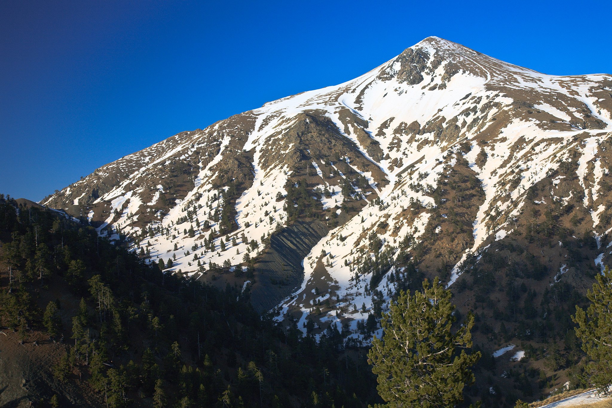
Mount Smolikas is the second-highest mountain in Greece, at 2,637 metres. It stands in Epirus, in the northern part of the Pindus range, above the valley of the Aoos River. It is a mountain for walkers. Marked paths climb from three small villages through pine and beech forest to open grassland, and no climbing skill is needed to reach the top. Just below the summit lies Drakolimni, the Dragon Lake, an alpine lake at about 2,150 metres. A mountain refuge above the village of Palioseli lets visitors make the climb in two days. The mountain is part of the Northern Pindos National Park, and bears and wolves live in its forests.
Geography
Mount Smolikas rises to 2,637 metres. It is the highest mountain of the Pindus range and the second-highest in Greece, after Mount Olympus. It stands in the north of Epirus, about 15 kilometres north-east of the town of Konitsa. The valley of the Aoos River runs along its southern side and separates it from Mount Tymfi. Mount Grammos is to the north-west and Mount Vasilitsa to the south-east. The streams of the northern side flow to the Sarantaporos river.
Smolikas is made of ophiolite, a dark rock that gives the ground a red colour in places. During the ice ages, glaciers filled the valleys of its northern and eastern sides, and the last of them melted about 11,500 years ago. Besides the main summit, the peak of Mosia also passes 2,500 metres. Above 2,000 metres the ground is open grass and rock.


Activities
People come to Smolikas for the climb to the summit on foot. The usual route starts at the village of Palioseli, at about 1,100 metres. It follows the national trail O3 through forest to the mountain refuge at Nane, then climbs a long ridge to the lake of Drakolimni and turns east to the summit. The climb takes about six hours. It needs no climbing skill, but it is long. Two more marked routes of about the same length start at the villages of Pades and Agia Paraskevi and meet the first one near the lake. From the village of Samarina, on the eastern side, a longer route crosses the peak of Mosia. It has sections of scrambling on rock.
The climb can be done in two days, with a night at the refuge. From there the lake is about an hour and a half away, and the summit about the same again. In late winter and spring, the snow on the high slopes draws ski mountaineers.


Nature & Outdoors
The best-known place on the mountain is Drakolimni, the Dragon Lake. It lies at about 2,150 metres on a shoulder below the summit, in open grassland, and its outline looks a little like a heart. The ground around it is red, from the rock of the mountain. Alpine newts live in its water, and wild orchids grow near it. Local stories say that a dragon lived in the lake.
Lower down, the slopes are covered with forest. Black pine and beech grow on the lower ground, and higher up stand old Bosnian pines, a tree of the high Balkan mountains that people here call robolo. Brown bears and wolves live in these forests. Smolikas belongs to the Northern Pindos National Park and to the Natura 2000 network.


Villages & Inland
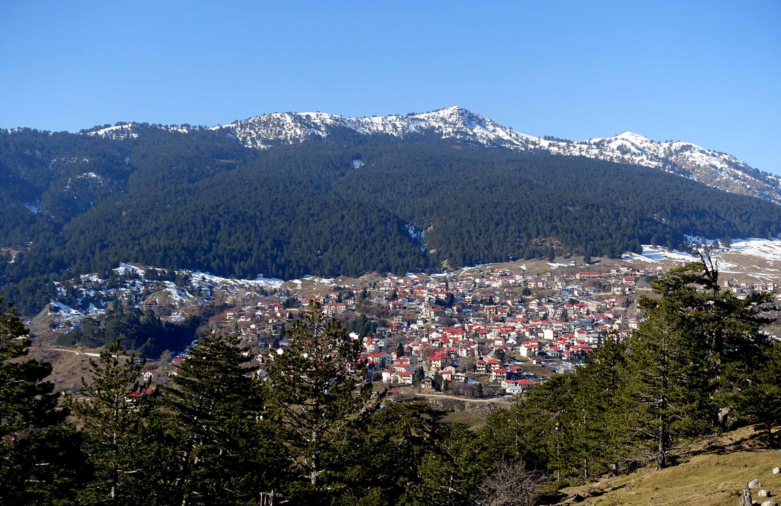
The villages of Smolikas are small, and most of them stand at more than 1,000 metres. On the southern side, above the valley of the Aoos River, Palioseli is the usual starting point for the mountain. Its church of Agia Paraskevi, built in 1864, leans to one side because the ground under it has moved. Pades, a little higher, has only a few people in winter. It has two old churches, one of them with wall paintings, and old watermills. The village of Agia Paraskevi, on the northern side, is the third starting point for the summit.
On the eastern side, in the area of Grevena, Samarina stands at about 1,550 metres. It is a stone-built village of the Vlachs, shepherds who for centuries moved their flocks between the mountains and the plains.
Practical information
Getting there
Smolikas has starting points on three sides, so choose the village before you travel. For the southern villages of Palioseli and Pades, drive from the city of Ioannina to the town of Konitsa, and from there to the villages. The village of Agia Paraskevi, on the northern side, is about 94 kilometres from Ioannina, a drive of under two hours. For the eastern side, drive to the village of Samarina, about 50 kilometres from the town of Grevena and about 220 kilometres from Thessaloniki.
Getting around
On the mountain itself everything is done on foot. The refuge at Nane stands at about 1,750 metres above the village of Palioseli, and a forest road climbs towards it from the village. Ask the refuge about the state of the road before you drive up. The paths are well marked as far as the lake of Drakolimni. Between the lake and the summit the marks are few, so in cloud it is easy to lose the way.
When to go
The walking season runs from late May to early October. May, June, September and October are the best months. In July and August, thunderstorms are common in the afternoon, so start early and be off the high ground by midday. In winter the mountain is under deep snow and the lake is frozen. February and March are the months for ski mountaineering, for people with winter experience.
Good to know
The refuge has beds for about 24 people and serves cooked food. It usually works from early May to early November, so book before you go. There is a spring at Nane, so fill your bottles there before the climb. Camping beside Drakolimni is discouraged, because it harms the ground around the lake. The weather changes fast, and the temperature can fall a long way in one day, so carry warm and waterproof clothes even in summer.
Mount Smolikas— been there?Tell others what you saw.
A photo and two lines are enough.
